
Study Butte
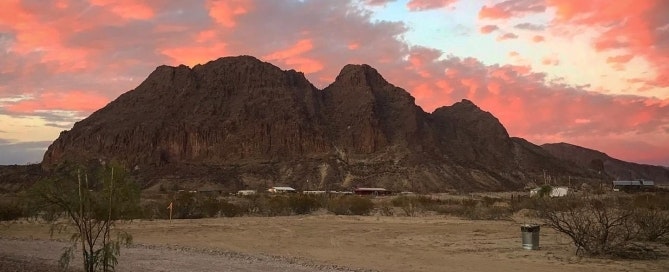
HUNDRED MILE VIEW
The Texas Mountain Trail town of Study Butte, named for a butte that rises just northwest of and 230 feet above the Highway 118 and FM 170 intersection, bears the remains of the Big Bend Quicksilver Mine at its base. Local doctor Will Study developed the mercury mine in the early 1900s and both the town and the butte feature his last name, pronounced “stoody”, as well as the artifacts of the quicksilver mining that first drew Anglos to the area. Although the mining of mercury, a process fraught with environmental consequences, brought some of the earliest travelers to town, the surrounding preserved natural environment, courtesy of the National Park Service, keeps them coming today.

Area mercury mines were closed permanently by late mid-century and the establishment of Big Bend National Park provided opportunities to explore the region’s pristine Chihuahuan Desert ecosystem.

Today, Study Butte serves as the western entrance of the million-plus acre park. Motels, restaurants, shops, and outfitters occupy the streets where miners once struggled to survive a meager living wage. A three hundred and sixty degree mountain profile enhances the community’s stark desert environs and, on a clear day, the view extends into Mexico over a hundred miles.
